No higher resolution available.
Central_Alliance_Finale.png (551 × 379 pixels, file size: 79 KB, MIME type: image/png)
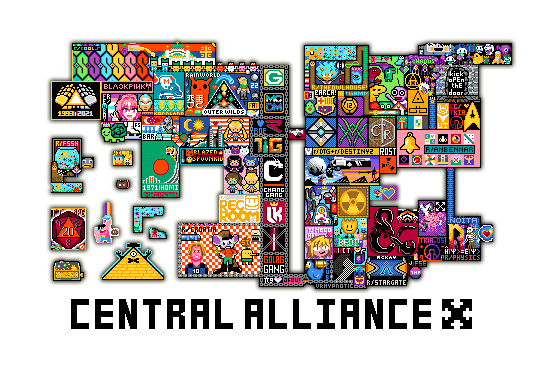
A map of the end of the Central Alliance at a slightly indeterminate time before the Great Whiteout. This map includes the various communities of the Central Alliance, as well as the colonial territories of some of the members.
- Image created by Discord User and member of the Central Alliance M. Friendly Neighborh-------- [Name cut off for Privacy Rights and Concerns]
File history
Click on a date/time to view the file as it appeared at that time.
| Date/Time | Thumbnail | Dimensions | User | Comment | |
|---|---|---|---|---|---|
| current | 05:50, 12 April 2022 | | 551 × 379 (79 KB) | ADV987 (talk | contribs) |
You cannot overwrite this file.
File usage
The following page uses this file: